
The Projects
The Roseau River Watershed District (RRWD), in partnership with the Minnesota DNR, is advancing the Roseau Lake "Rehabilitation" and Roseau River "Restoration" projects. The RRWD has been studying the Roseau Lake Basin for decades to reduce flooding in the region. The original Roseau Lake was drained in 1914 for agricultural purposes. But, RRWD claims that the area consistently floods, leading to losses of crops and decreased biodiversity among wildlife.
The Roseau Lake project was re-born in 2014 from this concern to reduce flood damage and improve habitats for wildlife. RRWD plans to build embankments and control structures along the Roseau River to help with flood storage in the Roseau Lake Basin. The Lake and River projects are inextricably linked, with the River portion reconnecting sections of the river and having similar devastating flooding effects on productive private farmland.
Project goals were rearticulated in a June 2019 Engineer’s Report with a similar emphasis on reducing flooding, improving conditions for wildlife, and preventing loss of crops for farmers. Most of the land in Roseau Lake is owned and managed by the Minnesota Department of Natural Resources (DNR). DNR has made attempts in the past to move forward with the project, but all previous attempts inevitably stalled from lack of funding or sustained interest.
History of the Projects
April 2026
Landowners testify in a House Legacy Fund Finance Committee meeting. A vote is scheduled for Wednesday, April 15, 2026.
March 2026
MN Senate Environment Committee meeting votes unanimously to pause funding. Now it goes to the House.
2026
Legislators meet with landowners to discuss options to support us against RRWD actions....
What Independent Hydrology Reviews Show
Landowners have gotten three independent hydrology reviews (at their own cost over $40k with another $100k in costs pending) which have reported that the flood reduction created through the projects will be minimal and will not protect against major 10-year and greater events. And critically, those projects are projected to flood up to 12,600 acres of productive private farmland, rendering it unfarmable.
- Minimal downstream flood reduction - RRWD's 2019 engineer report predicts that the project will reduce downstream flooding downstream by only 5% for the degree of flooding that occurs every 10 years, on average.
- Improvements to ecology and wildlife are not justified - project appears to simply divert habitat from downstream to the project area.
- Project cost is not justified
- RRWD engineer's cost estimate is low

Unauthorized Work and Flooding on Private Farmland
Project construction has occurred on private land—without landowner's knowledge or permission, using "phony" easements—that do not legally exit.
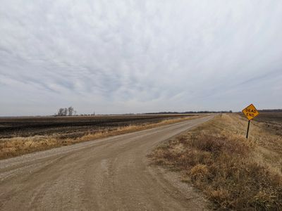
A 14’ high dam (water control structure also known as a weir) was built that not only blocks drainage ditch 51 but large of the dam was built on a landowner’s private land—and is flooding multiple landowners’ fields, seeing backups up to 3 miles.
Adding insult to injury, one of the landowner's private embankments was dug up and his own soil used to build the dam that's flooding his and others' land. After that dam was built, flooding has been observed across those private lands—with backups up to 3 miles.
This is just one example of how these projects are already affecting landowners and is part of the current federal lawsuit against the RRWD.
Agencies Involved in the Projects
Roseau River Watershed District (RRWD) – Formed in 1963, manages the watershed around the Roseau River in Roseau County. RRWD is the primary entity behind the project. Board members are not experts in hydrology but wield tremendous power when it comes to decision-making—including about the futures and livelihoods of these 100+ landowners.
Red River Watershed Management Board (RRWM) – Holds the real power behind the project. The RRWMB has several jurisdictions under its management that have membership on its board, including Roseau River Watershed District.
Lessard-Sams Outdoor Heritage Council – One of the major funders of the project, based in Minneapolis. The Council was established by the state legislature to provide annual funding recommendations to the legislature from the Outdoor Heritage Fund. This is one of several funds created by Minnesota State clean water legislation that seeks to restore, protect, and enhance Minnesota wetlands.
Minnesota Department of Natural Resources (DNR) – Manages and protects state land and water. Also provides outdoor recreation opportunities. The agency owns significant land in northern Minnesota, including much of the land in the project area.
Frequently Asked Questions
What is the Roseau "Lake Rehabilitation" Project?
What is the Roseau "Lake Rehabilitation" Project?
What is the Roseau "Lake Rehabilitation" Project?

- The Roseau River Watershed District (RRWD) and the Minnesota Department of Natural Resources wants to construct a series of embankments and water control gates around the Roseau Lake basin
- Their aim is to create a permanent marsh for waterfowl year-round, while attempting to minimize flooding downstream
- Thousands of acres of family farmland would be rendered unfarmable by disrupting seasonal flooding patterns
- The operational plan was proposed and passed without sufficient consultation of farmers and landowners in the project's footprint
- Alternative 1 is the Board's currently preferred alternative
- The Engineer’s Report states the project will be completed by 2022
How does the project affect flooding?
What is the Roseau "Lake Rehabilitation" Project?
What is the Roseau "Lake Rehabilitation" Project?

- The Watershed District’s own engineering report admits that the project will do nothing to reduce the threat or damage of larger (“10 year”) flood events
- The project aims to address the smaller ("5 year") floods, but these are already well-managed by Roseau farmers and landowners
- The project would hold excess water in the Roseau lake basin, preventing it from emptying as it normally does
- The project's proposed dikes are higher than those currently used by farmers to protect their land, which would result in the flooding spilling over onto privately owned farmland first, instead of filling the basin
- Should the project go through, the region would still be unprepared for larger, periodic flood events
- According to an outside engineer who reviewed the Watershed District’s plan: “…this project could deem several thousand acres unfarmable due to the increased risk of submergence due to the flood control, cutoff of access for farming equipment, and/or blockage of drainage”
Does this project use eminent domain?
What is the Roseau "Lake Rehabilitation" Project?
Does this project use eminent domain?

- Farmers and landowners in the project's footprint do not wish to sell their land and oppose this project
- Under the Board's previous preferred alternative (2A'), thousands of acres of privately owned land would have been taken to build embankments and easements
- While there is no longer a formal threat of eminent domain, the Board still has not disavowed the use of eminent domain
- Under the Board's now preferred alternative (alternative 1), land would be rendered unfarmable due to increased risk of flooding at key times during the growing season
- Landowners stand to face even more loss as a result of alternative 1, since their land will be flooded without compensation from easements
Who's paying for this project?
What are the proposed benefits?
Does this project use eminent domain?

- The watershed district’s engineering report estimates their preferred option for completing the project will cost just over $15 million
- The outside engineer who reviewed that report estimates the actual cost will be more than $15 million
- Exact figures have not been provided by the watershed district for the public to know how the project is being funded
- Taxpayers will likely foot a significant portion of the bill, and already have through RRWD local construction taxes
- Based on available information, the project would be funded by: state bonds, the Minnesota Department of Natural Resources, the Red River Watershed Management Board, Lessard-Sams Outdoor Heritage Council, and local construction taxes
- Previous iterations of the project have failed to go through due to lack of funding/sustained interest
What are the proposed benefits?
What are the proposed benefits?
What are the proposed benefits?
- While RRWD states the project will improve spring and fall migratory waterfowl habitat, this will not be the case, as the spring is prone to flash floods when river heights can overtop the banks and de-nest the ducks
- The DNR already owns thousands of acres, including 40% of the watershed area, that can be converted into a habitat for ducks without destroying farmland
- Upland game currently hunted in the area will be displaced by the project
- While RRWD states the project will enhance recreational activities like fishing and boating, the reality will be a permanent marsh that attracts pests, not fish
- The permanent marsh will average six to twelve inches of water, which is no place for boats or fishing but a hot spot for mosquitos and ticks